


An Iconic Project for Laos
Learn more about what makes Nam Theun 2 one of the most successful industrial endeavors in Laos, owing it the name of “multipurpose project”.

Head Office: House No. 249, Unit 15, 5th and 6th Floor
Vatnak Village, Lao-Thai Road, Sisattanak District
P.O Box 5862, Vientiane Capital, Lao PDR
Tel: (856-21) 263 900, Fax: (856-21) 263 901
Tel: (856-51) 620 440 Fax: (856-51) 620 439
Nam Theun 2 Power Station: Sangkeo Village, Gnommalath District,
Khammouane Province
Installed capacity: 1,080 MW
Average annual energy produced: 6,000 GWh
Project Statistics
Installed Capacity
Annual Supply
Nakai Dam Height
Catchment Area

The Nam Theun 2 is committed to manage its operational risks related to its activities in terms of health & safety, hydro-safety and environmental for its staff, contactors and communities.
News

The Prime Minister of Laos paid a visit to Nam Theun 2

Nam Theun 2 Hands Over Successful Projects to Gnommalath District

Thrilling moment! Pelton Unit 11’s rotor lifted off for the first time

The NT2DF Steering Committee meeting No. 7

Nam Theun 2 donated the sport equipment to Bounbao High School

Safety Day 2023
Environments
The Nakai-Nam Theun National Park is a key area within the Indo-Burma biodiversity hotspot, spreading across Khammouane and Bolikhamxay provinces.
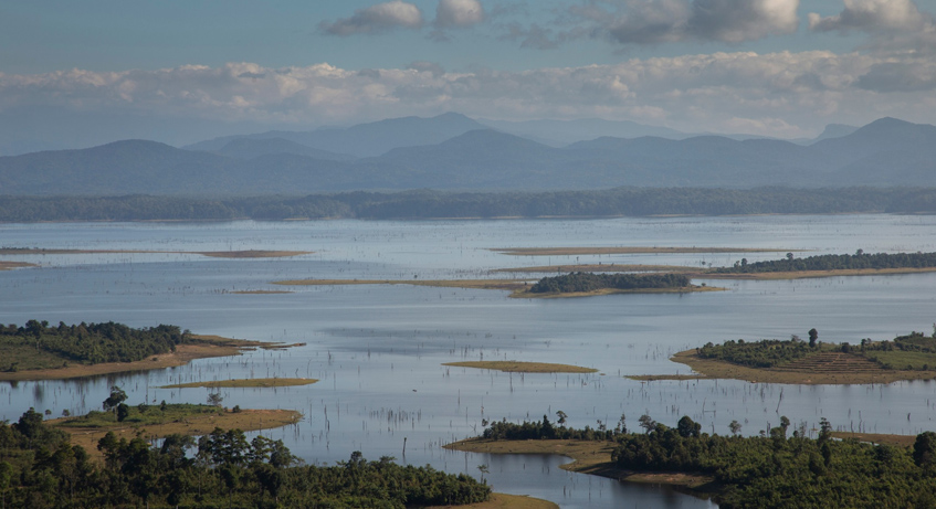
Nam Theun 2 provides in-house expertise on water chemistry, hydrobiology, greenhouse gas emission and wildlife in relation to the Nam Theun 2 hydro system.
Join Our Team
Explored our opportunities
